
INTS Link-11 Simulation
The INTS Link-11 simulator provides simulated tactical Link-11 message exchange based on the SISO standard for Link 11/11B simulations (SISO-STD-005-V9).
The INTS Link11 simulator is intended for tactical message exchange between own ship cubicles during tactical exercises and it provides instructor functions (INTS Link-11 Instructor), monitoring and role playing.
Link-11 Nets
The IFAD Naval Tactical Simulator (INTS) supports 4 Link-11 nets per exercise. The own ships are assigned to one net at a time.
INTS Link-11 Instructor
The Link-11 Instructor provides functions to set up, monitor and participate in the Link-11 nets.
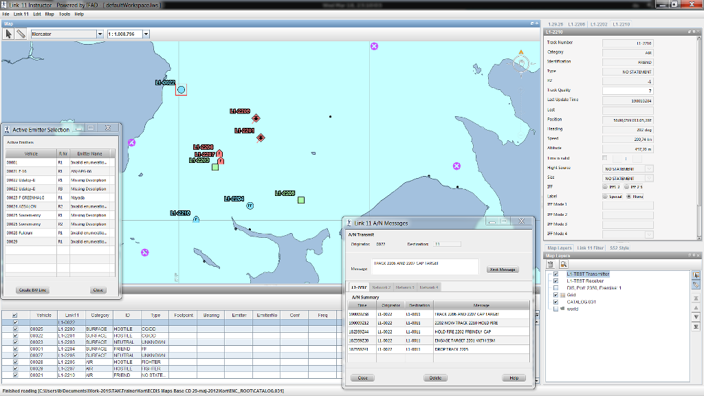
All functions related to transmission and reception of Link-11 information are handled in the INTS Link-11 Instructor.
The INTS Link-11 Instructor has a tactical display and a set of dialogues and totes for link transmissions, detailed information, filtering and delete functions.
Each instructor can monitor multiple Link-11 nets and actively participate on one net as a role player.
The tactical display can show the combined tactical Link-11 picture overlaid with the exercise (simulated entities).
The INTS Link-11 Instructor can receive and transmit the following message types:
- Tracks
- EW Lines
- Pointers
- Alphanumeric messages
Configuration
The INTS Link-11 Instructor is installed as an add-on to the Naval Tactical Simulator (INTS) Instructor on the instructor stations.